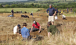
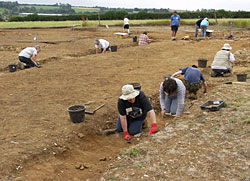
The excavation season of 2004 saw a major development in the operation of the research excavation at Whitehall Farm. For the first time the entire excavation was carried out by our own local volunteer workforce. Although the number of people on site was significantly lower than in previous years the standard of excavation and recording was extremely high. The ability and commitment of the workforce reflects well on the role of community-led archaeological projects in recording the past.
Targets
The project established several research targets for this years 'dig', notably we needed to:
investigate the remaining elements of the contexts situated in Room 3b
continue the exploration of the Roman drainage system in the vicinity of the bath house
explore the area to the east of the bath house for evidence of any further structures
investigate the layout of the courtyard and of the west wing of the villa complex.
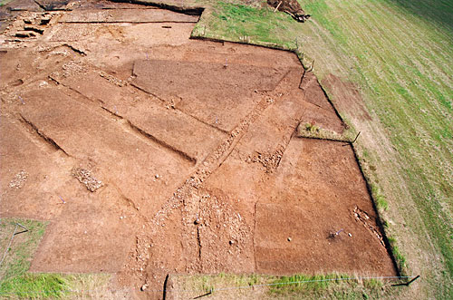
Clearing the site The west wing
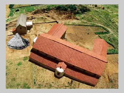
THE BATH HOUSE
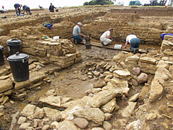
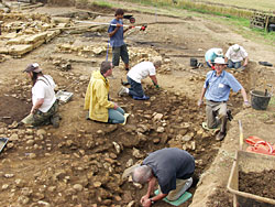
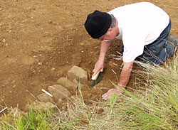
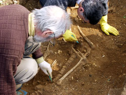
Room 3b
Work continued on retrieving the last vestiges of the contexts associated with the mid to late 3rd century AD reconstruction of Room 3b of the bath house. An examination of the natural base layers introduced unexpected finds of two wooden stakes driven into the ground surface. These wooden stakes are not sufficiently large to be part of a system of piles underpinning the bathhouse walls and they probably represent an earlier 2nd century AD pre-bathhouse phase of activity in this area of the site.
Working in room 3b
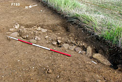
The Drainage System
It is now apparent that the drainage system is more complex than we had previously believed and undoubtedly the entire slope underlying the bath house and villa range was built on a grid pattern of culverts. The date of the drainage system is most likely to be early 3rd century AD in line with the initial construction of the main villa/bath house range.
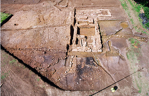
Drainage and area to east of bath house Roll mouse over photo to see areas excavated in 2004
East of the Bath House
The area to the east of the bathhouse was extended and has revealed a more substantial sequence of archaeological contexts than was previously considered to exist. Although the area immediately outside the bath house east wall is covered by the detritus associated with the waste material from utlising that building, underneath this material we found evidence of an earlier pre-bath house structure. All we have at the moment are the northwest corner foundations of a building aligned north-south along the slope and an extensive area of box flue tiles situated within the possible area of that structure. Undoubtedly we have another building but its date and function are still obscure and indeed the extensive deposit of boxflue tiles may equally represent a dump of material extracted from the bath house during a 4th century AD phase of reconstruction.
THE VILLA RANGE
The courtyard
Courtyard Roll mouse over photo to see areas excavated in 2004
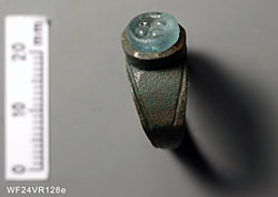
The excavation of the courtyard surface was extended to the south-east and a ditch limiting its extent was recorded. We do not know yet whether the ditch is a boundary marker or the drainage ditch for the roadway which passed obliquely across this part of the site. A very interesting 3rd century AD ring with a glass intaglio was discovered in the fill of the ditch.
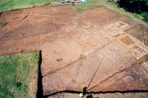
A major element of this year's excavation has been to uncover and record the plan and chronological development of the west wing of the villa. The area has been very badly robbed and is considerably eroded and denuded; however, sufficient has remained to enable the overall plan and dimensions of the building to be recorded. We can now demonstrate that the Whitehall Villa had a suite of rooms constituting a wing to the south west of the main villa range. Unfortunately, as with the rest of the main range of the villa, the mosaic pavements and fine painted plaster walls have gone and only fragmentary elements of the foundations have survived. The internal partitions are for the most part difficult to identify although the central internal wall cutting the wing into two elements is visible. We should probably envisage a suite of four rooms of roughly equal size contained within the structure. However the construction suggests that this wing was added to the main range possibly in the 4th century AD. In fact the corridor and porch may have themselves been added to the main range in an intervening phase of construction towards the end of the 3rd century AD.
West wing and roundhouse Roll mouse over photo to see areas excavated in 2004 (red shading shows west wing area: green shading shows 'new' roundhouse)
Another roundhouse
Lying immediately to the south west of the villa's west wing we uncovered the structural remains of another round house. There are two aspects that are of interest in this discovery: first, the preservation of the external wall where the foundations and possibly the first course of wall stones survive, even though this area of the site has the least depth of plough soil coverage and is particularly vulnerable to ploughing. This underlines the fact that the major destructive process inflicted on the site is probably not the 20th century arable farming regime but the systematic robbing of the surviving remains in the 19th century to meet the needs of the post enclosure faming landscape. The second point of interest is the fact that we have two stone roundhouses either end of the main villa range. This form of layout is not unique to our part of Northamptonshire and in fact we know that at the Horestone Brook Villa, the nearest neighbour to Whitehall Farm, the same situation exists. The recent excavation of another villa estate at Easton Maudit also has the same configuration. These findings demonstrate that two roundhouse linked by a rectangular main range appears to be a recognised development plan for modest sized villas located in the Upper Nene. However although we can recognise this form of development it is difficult to determine why such a course of action was taken.
POST EXCAVATION WORK
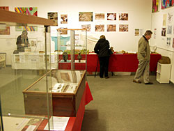
The recent exhibition held at the Small Plaice Gallery enabled us to display some of the reconstructed vessels from the marvellous collection recovered from the undisturbed contexts excavated in Room 3b.
Whitehall Farm has a magnificent assemblage of material culture and the continuing investigation of these remains will change our understanding of the day-to-day life of the Romano-Britons who lived here. An initial investigation and identification of the bone assemblage by Vicky Coulthard and James Summer has now been completed. Their work has underlined the importance of the assemblage to the study of faunal remains in Roman Britain. It also affirms our excavation policy in terms of the diligence and effort expended in retrieving this material and the attention to detail in sieving the whole of the context.
Dr Naomi Sykes of Southampton University and an eight strong post-graduate team of students will be exploring the animal bone assemblage in greater detail and they hope to look particularly at the wild animal component of the assemblage and the social implications of the diet for our Romano-British population. Their work may be able to develop our understanding of people's habits and social behavior and whether such material is indicative of a feasting culture or just a wide well-balanced diet.
ANGLO-SAXON CEMETERY
The Whitehall excavation team has also been busy elsewhere on the farm - further work has been undertaken on the Anglo-Saxon cemetery.
This section of the report has its own page: click here.
WHITEHALL BONES IN REGIONAL STUDY
The Roman and Saxon remains at Whitehall Farm are also being used as key examples in a wider regional study undertaken by Oxford Archaeology for DEFRA and English Heritage. The aim is to develop a theoretical model to try and ascertain the potential for archaeological survival of settlement sites in the East Midlands. The project entails 'digging' selective test pits across monuments to find out at what depth archaeology survives, to assess the impact of agriculture and whether the depth of soil cover or colluvium is a significant factor in preserving archaeological contexts. These findings will help to formulate future archaeologically friendly rural and conservation policy in Britain.
Copyright of this web site, including all text and images (except where otherwise stated), belongs to The Whitehall Farm Roman Villa and Landscape Project. No part of this website may be reproduced in any form without the prior permission of the Project.