| Fieldwork: Geophysical Survey
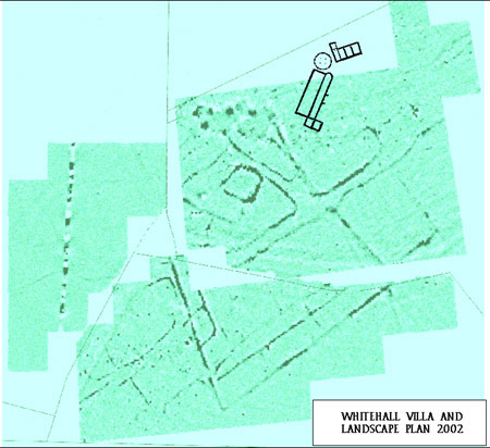
Funding became available to undertake a geophysical survey to assist in establishing the nature and extent of the site. Northamptonshire Archaeology was commissioned to undertake the fieldwork and report on the extent of possible anomalies representing the buried archaeology. Surveys were conducted in 1999, 2000 and 2002. The plan below shows the latest geophysiscal data with the outlines of the round house, villa and bathhouse added.
The full reports may be downloaded and viewed as Adobe Reader documents (.pdf):

Our thanks to Peter Masters and Cranfield University for the use of this image
Click on the map for a larger copy in a separate browser window.
|

