WHITEHALL 2007 - The Test Pits
Stephen Young, Archaeological Director
27 July 2007
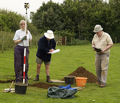
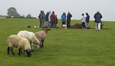
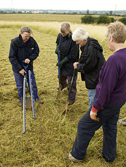
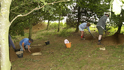
The rationale behind this year's series of test pitting (on July 23rd to 25th) has been to investigate some unexcavated areas of the site. This will assist us in identifying our future research priorities and accessing what is left of the archaeological stratigraphy to plan for further seasons of fieldwork. It is important for this exploratory work to be undertaken because the farmer, Nick Adams, is applying for the site to become part of Natural England's Higher Level Stewardship scheme. We therefore need to know what is out there in case we cannot get back on to any particular areas in the immediate future.
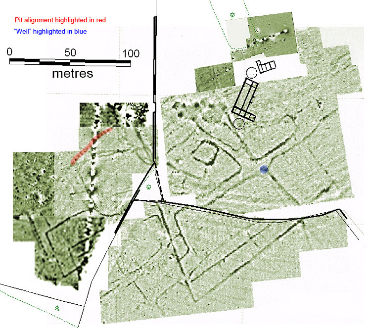
I chose five areas of the site for test pitting examination. The first area was associated with the pit alignments, which we know cover part of the Whitehall Farm site from the geophysical survey carried out initially in 2000, and revisited again last week.
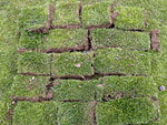
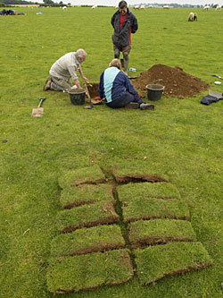
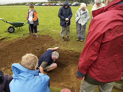
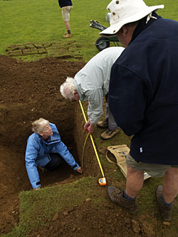
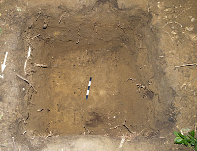
We have at least two major alignments of pits crossing the pasture field previously known as Upper Roughborough. Therefore it was important to see what they looked like archaeologically, so that if we do any further work on them, most volunteers will recognise the profile and the archaeological approach needed to excavate these features. Those of you who have "dug" on the site understand the geological complexity of the sub-surface strata and will understand the value of this exercise. In total the excavation team "dug" four test pits across the pit alignments located through the geophysics to try and identify the imprint and profile of the feature.
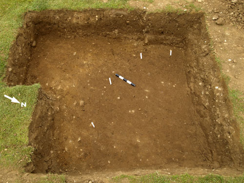
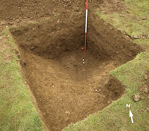
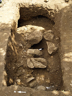
The first three pits were rather frustrating and we did not find anything. Fortunately in the fourth pit we found the edge of the feature, shown here by the white pegs...
... so we were then able to extend the pit...
... to reveal about two-thirds of one of these pits forming the pit alignment.
They are roughly 1.5 meters deep and just over a metre wide. We have retrieved no dating evidence from them but this is not unusual for this type of archaeological feature. However, when you look at these features in other archaeological contexts they are thought to date from anywhere between the late Bronze Age to the late Iron Age-early Roman period. At the moment all we can say is that they could have been dug anywhere within that period. Indeed these pits are often maintained over long periods of time and ours might span the whole of that period, but because we have not got any dating evidence, we might never know! These pit alignments are traditionally interpreted as some sort of property boundary. An interesting thing about the fill of our pit is that it seems to be one extensive fill. There is no evidence of being "re-dug" indicating that the pit has remained open for a long time and been kept clean.
In the same field in another area, we also looked at test pitting the field system identified through geophysical survey, which is a bit further south from the pit alignment. The intention here was to see what remained of the archaeology, but also to see whether this was a potential area for the location of a cemetery. We excavated two test pits and they revealed that the area has actually been extensively damaged by the furrows from the medieval ridge and furrow system of farming. Although a disappointing outcome this is quite useful for future research purposes. There was also no evidence of human bones or graves so it looks as if the area was dominated by the field system, though obviously we would need to excavate more pits if we wanted to find out more and be definitive on this subject.
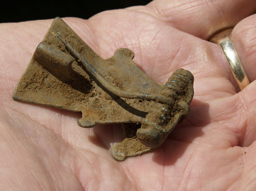
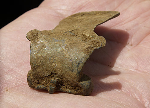
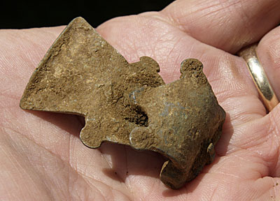
However also close to this area, Dave Derby and Tim Binns have been undertaking a metal detecting survey and they located a 1st century brooch - a crescent brooch of the Aesica type. It is a very fine example and we've got the whole of the brooch. It just needs to be conserved now.
The appearance of this late Iron Age or early Roman brooch is in the same area where two bronze late Iron Age coins were found. We have also got Iron Age pottery from the general area, so we know the big enclosure identified on the geophysics, which appears to contain a round house, confirms the position of the pre Roman occupation at Whitehall Farm.
I am pleased we were able to achieve our aim in the pasture field and this will help us considerably in the future.
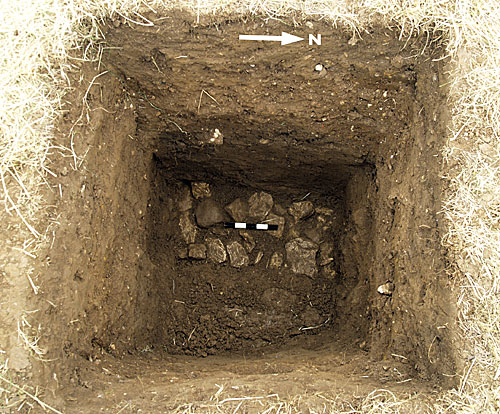
I also wanted to put some test pits into the triangular copse between the pasture field and Longlands (the field that has the villa site in it) because according to oral tradition a lot of possibly worked stone has been put there by farmers over the last hundred years. I also wanted to see if we could get the profile of the ditch and bank which formed part of the villa complex that runs through the copse and track its alignment. We therefore excavated two test pits and managed to identify both the east and west edges of the ditch and recover some good dating evidence from its fill.
We did not find much stone in there, which is interesting but unfortunately not very illuminating. However it confirmed that some of the modern boundaries actually do mirror the Roman and earlier boundaries even now.
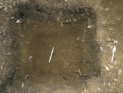
We also investigated another spot in Longlands field with a single test pit to see if we could identify any archaeology to go with the anomaly that had been identified on the geophysics and which might indicate the location of a possible well.
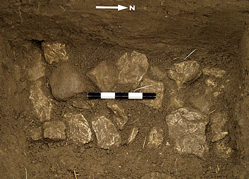
Those excavating the test pit found, at a depth of 1.24m, the foundations or footings for a wall which was about 30cm across.
Perhaps we do have a well - or will it turn out to be something else? However it does confirm that there is archaeology at that depth in that part of the field, which means that when we decide to excavate the area we shall encounter good surviving stratigraphy. The anaerobic conditions that appertain here indicate a level of environmental survival equal to that found in the bath house. Thankfully we were able to achieve our goal with one test pit as I am sure digging further test pits would have been a tedious activity at that depth.
Finally we also investigated either side of the modern field boundary that now separates the old 60 acre field of Roughborough, to assess whether we actually had a quarry at the end of the field, as suggested by the significant drop in level, or whether it was a natural slope. We put two test pits into the tree lined boundary and they confirmed that the feature is a natural slope and not a quarry.
A third test pit on a stone outcrop immediately adjacent to the field boundary produced evidence of stone fracturing possibly for producing hardcore material but nothing to date the feature was recovered during its excavation. A 17th or 18th century date is just as likely as a Roman one.
Therefore to sum up the evidence and initial dating: the pit alignments are extensive and probably pre Roman, the field system in the pasture field is early Roman, probably late 1st through to the early 2nd century, and does not appear to have been utilised as a cemetery at a later time. The fill of the anomaly excavated in Longlands field from initial analyses of the pottery can not date before the mid 2nd century and may be more indicative of a 3rd century AD date. The ditch in the copse is consistent with a late 3rd century AD construction date as previously assigned to the feature during our excavations on other parts of the ditch located elsewhere on the site.
So overall I think we have achieved what we wanted to do and have addressed a few of the issues which needed resolving and importantly we have produced some findings that will help to shape what we do in the future.

Back-filling!
|